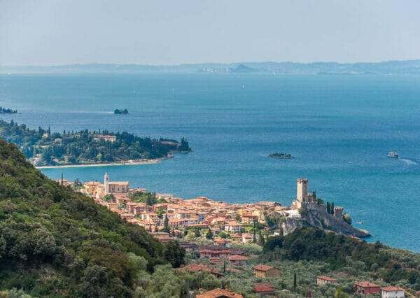
Path 1 of the Nordic Walking Park of Malcesine

Ariella Bickhove
Nordic walking, trekking and via ferrata

This is the red route number one of the Nordic Walking Park.
Leave the centre of Malcesine along the bike path in flat terrain towards Campagnola and come back walking on a gentle ascent through the olive groves along Via Navene Vecchia road. This is an easy route, light blue that always enable you to practice the Nordic Walking technique.
The circular tour along the beaches and the olive groves, leads you from Malcesine to Campagnola along the beach. It takes you back to Malcesine on a small footpath along Via Navene Vecchia road.
Be ready for a 6,6 kilometers route involving 150m of both elevation gain and loss. It’s an easy route, suitable for everyone, also good as a relaxing walk and to stretch your legs.
Maps and GPS Track
Details
-
Technical characteristics
- Starting point
-
Endpoint
Malcesine
-
Route
Malcesine – Campagnola – Malcesine
-
Starting height
77m
-
Highest point
124m
-
Altitude – ascent/descent
139m/137m
-
Distance
6,5 km
-
Duration
1,2 hrs
-
Difficulty
-
Difficulty
easy
-
Difficulty scale – Nordic Walking
light blue
-
Technical difficulty (1 to 5)
1
-
Physical training (1 to 5)
1
-
Difficulty
-
Type of route
- Round tour
- Multi-stage tour
- Panoramic route
Partner
Tour description
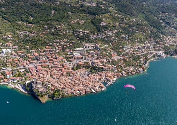
From Malcesine go down to Paina, on the northern side of the Scaliger castle, along the beach and keep going on the bike path passing through the small port of Retelino and the paragliding landing area.
Once you reach Campagnola, cross the Via Gardesana road by the Hotel Sailing Center and go up on the tarmac road leading to Via Navene Vecchia road.
Keep heading south and uphill then take the small street on your right, immediately after the B&B Casa Benamati.
Keep walking toward South on a small uphill footpath that goes among the olive groves for about 1,5 chilometres.
When you get to the end of this footpath you are on Via Navene Vecchia road. Keep going South in flat terrain for a little while and then downhill until you get to Malcesine.
Shorter way
This is the n.1a route of the Nordic Walking Park: the Sottodossi circular route.
This is the shorter way: instead of going down towards the beach, get the Via Navene Vecchia road that leads to the lower cable car station. After the cable car station, before the uphill, take the street on the left to Località Sottodossi and keep going on a dirt road that stretches inside an olive grove. At the end of the dirt road, go down on the left on a steep downhill ending up on the bike path.
Turn left, head South and keep going, walking along the beach, till you’re back in Malcesine.
- Length: 3,6 km
- Difficulty: easy
- Duration: 45 minutes
The tour in the wintertime
This itinerary is accessible all year round thanks to its low elevation.
Shelters, huts or bivouacs along the trail
None.
Partner

How to reach the starting point of the trail
The path starts in Malcesine.
Parking
In Malcesine.
Here you have the list of the parking lots located in the center of Malcesine.
Public transport
- From Torbole or Riva del Garda take a bus travelling south to Peschiera/Verona.
- From Peschiera or Verona take a bus travelling north to Riva del Garda.