A panoramic walk in Torbole and Nago among the signs of history

Angela Trawoeger
Creator, photographer and content manager
An easy, scenic route of almost 6 km from Torbole to Nago, passing by the Marmitte dei Giganti and Castel Penede. Return to Torbole by descending the historic mule track of Valletta Santa Lucia.
This route is not very well used, especially in the low season, and is perfect for stretching your legs for a couple of hours on an undemanding route.
Map and GPS Track
Details
-
Technical characteristics
-
Starting point
Torbole
-
Endpoint
Torbole
-
Route
Torbole, Marmitte dei Giganti, Nago, Castel Penede, Valletta Santa Lucia, Torbole
-
Starting height
86m
-
Highest point
270m
-
Altitude – ascent/descent
264m/263m
-
Distance
6km
-
Duration
2 hrs
-
Starting point
-
Difficulty
-
Difficulty
easy
-
Technical difficulty (1 to 5)
2
-
Physical training (1 to 5)
2
- CAI (Italian Alpine Club) difficulty scale
-
Difficulty
-
Scenic appeal
-
Experience (1 to 5)
4
-
Landscape (1 to 5)
4
-
Experience (1 to 5)
-
Type of route
- Round tour
- Panoramic route
- Suitable for families and children
-
Best time of year
-
All year over
without snow
-
All year over
Partner
Points of interest along this walking trail
Marmitte dei Giganti (Potholes of the Giants)
The Glacial wells of Nago-Torbole, known as the Giants’ Poholes, were formed millions of years ago as the melting ice shaped the rocks smoothing their surfaces.

Castel Penede
Penede Castle, built by the Counts of Arco in the first decade of the 13th Century, protects the old Roman Road between Alto Garda and the Adige Valley.
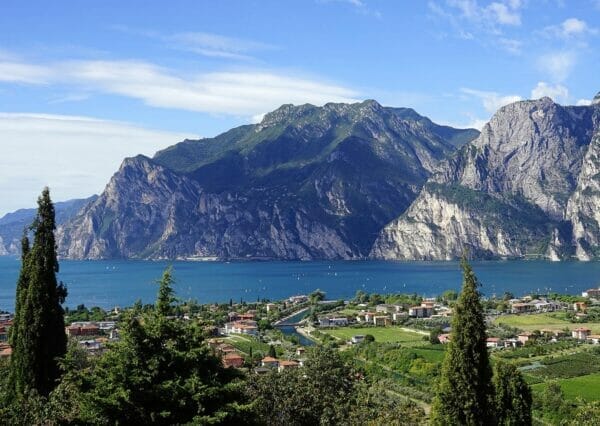
The ruins of Penede Castle are in the small hamlet of Nago at the end of a rocky shoulder facing Lake Garda.

Valletta Santa Lucia
The Valletta Santa Lucia, rich in dry-stone walls, terraces and olive groves, is reached by an old Roman Road. It was the only road to join the Adige Valley, Lake Garda and the Padana Plain.
History tells us that, to rebel against the rule of the Visconti in 1439, the Venetians transported a whole fleet of galleys to Torbole passing through the Valletta of Santa Lucia. The fleet, consisting of 25 boats and 6 galleys, reached Mori by the Adige river and were then transported to Lake Garda by oxen, wagons and brute strength.

Tour description
From the Panorama parking, turn north at the exit near the S. Andrea church and take the steps down that you find on the left. Go straight on for a few metres and go down the second flight of steps on the left to get to the small port in Torbole. Walk along the cycle path along the beach til you get to the Santa Maria church. Here turn right to get back to the Gardesana Road, go across and into Strada Granda.
Stay on Strada Granda for about 800m and turn right at the “Marmitte dei Giganti” sign, then left and keep right following a path through the fields.
Now you start a gentle uphill climb through the olive groves that brings you to the start of a path that zig zags up for 200m until you arrive at a bench. Here go downhill on your right to get to the Potholes of the Giants.
Now go back to the bench, go left to get to the main road where you go uphill for a few metres along the side of the road until you get to Belvedere on your left. Here you need to carefully cross the road – the road is very busy and there isn’t a pavement or zebra crossing so be careful. Go into the road ahead of you signed “Garda Trek Low”.
Go straight on along this easy rough road until you get to Nago alongside the big roundabout. Go across the road, go up the steps in front of you and turn right. Go straight on until you get to the field underneath the Penede Castle.
Take the path on your left which brings you to the Castle up a short climb. The Castle on the rocky spur is closed for restoration at present.
Now go back to the entrance to the downhill path on the right on the corner, turn straight away to your left and go on downhill for about 400 metres until you get to Nago.
Go past the face between the houses, turn right and keep right to get onto the old mule track of “Valletta Santa Lucia” which will take you quickly to the Santa Lucia road and then to a small fork in the road between the AktivHotel Santa Lucia.
Turn left, go across “Via Brae” and go on along “Via della Chiesa” for a short while to get to the S. Andrea church and the Panorama parking.
Variant
Castel Penede is closed for restoration: if you are not interested in seeing it from the outside, turn left following the signs for “Garda Trek Low” a few metres before arriving at the castle.
Partner
Our suggestions
- This route is easy but there aren’t many path signs: download the GPS coordinates if you don’t want to get lost!
- There are many refreshment places in Torbole and Nago but we suggest that you take water and something to eat or even a packed lunch if you stop for a Lake View.
The tour during the winter
All year round
Places to eat and refreshment points
In Torbole and Nago.
How to reach the starting point of the trail
In Torbole, at the small harbor, turn right (if arriving from the south) or left (if arriving from the north) into Piazza Goethe, cross it, and take Via Riccardo Pontalti uphill on your left. At the junction, after the traffic lights, turn right onto Via Santa Lucia, then immediately right onto Via Delle Brae, and continue for a few minutes to the Panorama car park on your right.
Parking is chargeable from about March to November.
Public Transport
- From Verona: ATV bus number 163/164 and 483/484, changing at Garda.
- From Torbole or Riva del Garda: ATV bus number 483/484


