Easy walk from Pregasina to the most famous viewpoint in Alto Garda

Angela Trawoeger
Creator, photographer and content manager


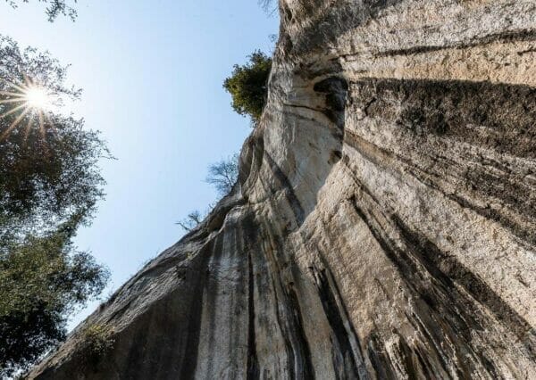
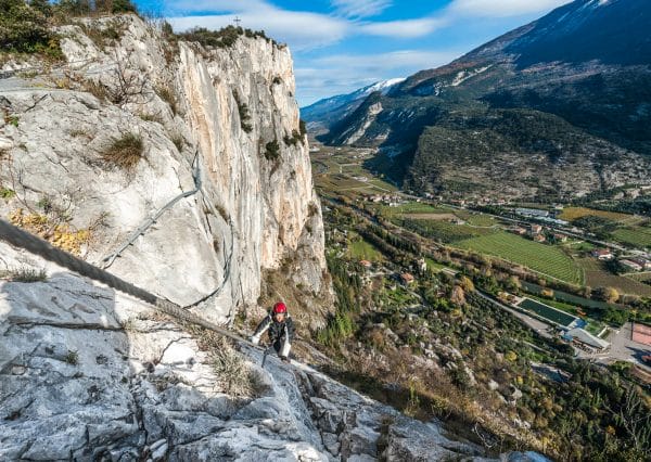
Punta Larici is located between Lake Garda and the Ledro Valley; getting there is pretty easy, and the path through the woods does not require any special technical skills. It just needs a little attention on the exposed section from Bocca Larici to Punta Larici.
An easy walk awaits you that, from Pregasina in about half an hour, takes you to the rocky outcrop of Punta Larici at about 900 meters above sea level. The view from up there is one of the most beautiful ever, every hour, every season of the year.
Map and GPS-Track
Details
-
Technical characteristics
-
Starting point
Pregasina
-
Endpoint
Punta Larici
-
Route
Pregasina, Bocca Larici, Punta Larici
-
Starting height
532m
-
Highest point
907m
-
Altitude – ascent/descent
469m/136m
-
Distance
3,2 km
-
Duration
1,30 hrs
-
Starting point
-
Difficulty
-
Difficulty
easy
-
Technical difficulty (1 to 5)
2
-
Physical training (1 to 5)
2
- CAI (Italian Alpine Club) difficulty scale
-
Difficulty
-
Scenic appeal
-
Experience (1 to 5)
5
-
Landscape (1 to 5)
5
-
Experience (1 to 5)
-
Type of route
- One way tour
- Panoramic route
- Suitable for families and children
- Insider tip
-
Best time of year
-
All year over
without snow
-
All year over
Partner


Points of interest
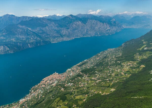
Definitely the view: you could lose hours looking at the mountain ridges, the small towns of Malcesine and Brenzone below on the slopes of Mount Baldo, Limone Sul Garda just below you, Torbole, Riva, and Arco with Mount Stivo looking north.


You will understand precisely why Lake Garda is referred to by northern European peoples as an Alpine lake with a Mediterranean flavor when you are there.
Whenever we feel like an easy walk, we go there to stretch our legs. It has been done and done a thousand times, and we still haven’t tired of it.
Description
From the parking lot below the church in the small village of Pregasina, take the forest road to Malga Palaer on trail 422b until you reach Bocca Larici.
You walk on an easy forest road, mainly in the woods, with a few viewpoints at the beginning of the trail that are just a tiny preview of what awaits you at Punta Larici.
At the forest exit at Bocca Larici, take the path to the left that, in 5 to 10 minutes, takes you to the viewpoint at Punta Larici. Be a little careful here because it is exposed, especially with children.
The return is on the same route.
Variant
- If you need to walk more, you could start walking from Riva del Garda by taking the Ponale path. When you get to Regina Mundi, continue straight on the main road to the little church in Pregasina. I would extend the route by a good 2 hours. (Total length one way: approx. 10 km – Elevation gain: approx 900 D+). If the outward and return trip becomes too strenuous, you can take the bus from Pregasina to Riva del Garda to go up or down.
Our tips
- Avoid holidays and weekends if you can; this route is so easy, scenic, and Instagrammable that you may find several people along the route with some difficulty parking.
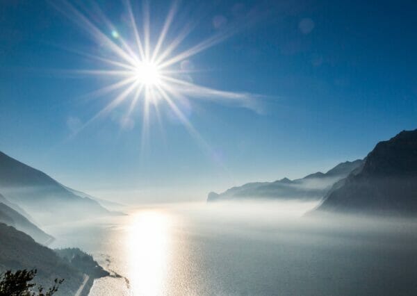
- Parking in Pregasina is small and free: leave early in the morning to find a good spot. Also, early in the morning, especially in summer, it is clearer (as well as less crowded), and it will be easier for you to be able to see all the way south across the lake.
- You will find a water fountain at the church to fill your water bottle; leave with a packed lunch for a break with a view at Bocca Larici or Malga Palaer, which is 10 minutes from Bocca Larici.
The winter hike
Punta Larici is located at 907 meters above sea level, and except for some rare snowfall at those elevations, this hike is passable year-round.
Rest stops
In Pregasina
How to reach the starting point of the hike
By car
Pregasina can be reached in about 15 minutes from Riva del Garda, following the signs for Val di Ledro (S.S. 240). At the end of the long tunnel, turn left, following the signs for Pregasina.
Public transportation
Pregasina is connected to Riva del Garda by an extra-urban bus line (214) which runs a few times a day.