Show all photos
Show all photos
Show all photos
Show all photos
Show all photos
Show all photos
Show all photos
Show all photos
Show all photos
Show all photos
Show all photos
Show all photos
Show all photos
Show all photos
Show all photos
Show all photos
Show all photos
Show all photos
Show all photos
Show all photos
Show all photos
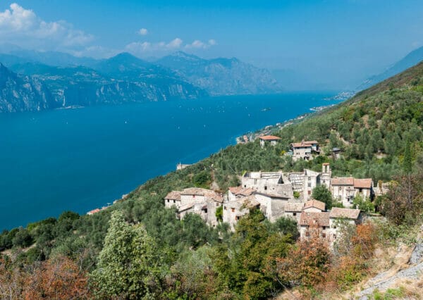
A beautiful trek through isolated and evocative countryside of high environmental importance.
A medium/difficult route that takes you to Cima Telegrafo leaving from the Val Trovai/Punta Veleno road. This trek is fairly hard work and the uphill section is about 6km long over an ascent of 1250m.
Points of interest along the hiking trail to Telegrafo peak
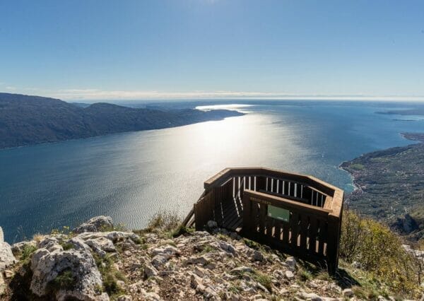
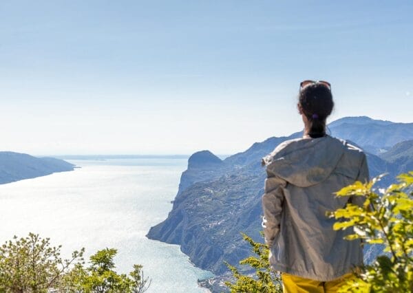
The amphitheatre below Cima Telegrafo is beautiful, a glacially formed circle, all the views along the ascent and the fantastic panorama from Cima Telegrafo at 2200 m.a.s.l.
The Telegrafo refuge is just below the peak and is run by people from Equipe Natura – we recommend the simple and traditional dishes especially those of local produce.
View from Cima Telegrafo
Trekking route description
Walk along the tarmac road until you find the start of path 654 signed to Telegrafo and the Taccole via ferrata. Follow the path until you get to a rough road in the beech wood. You come to a clearing with a well and, 300m afterwards take the path at the corner on the right which goes back into the woods where the track becomes a single track path (take care not to take the forest track under the rock wall which is close by).
You come to a fork in the road signed to the left to “Forcelin”. Keep going right and go uphill for another 2 and a half hours, following signs to Telegrafo.
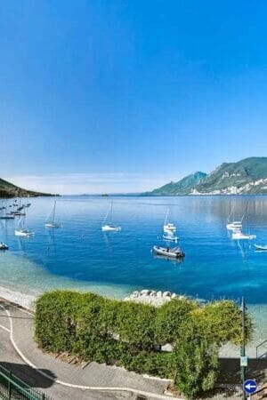
The route goes between a gravel path and rough track with panoramic views over the lower Lake Garda, the valleys, the glacial circle and the “Vetta della Buse”. At the fork with signs for “Baito Buse and Turri”, path no. 55, keep left staying on path no. 654 and straight away the amphitheatre under Cima Telegrafo opens out with the alpine pastures typical of this region. Carry on uphill until you get to the refuge that you see in front of you during the ascent.
Cima Telegrafo is just above the refuge of the same name.
Go up taking the path that is behind the refuge.
Variant
You can go up or down following signs to “Forcelin”.
This track is more difficult and even more spectacular.
Going up or down from “Forcelin” you make the route longer by about 30 minutes.
This variation is recommended for expert walkers.
Our suggestions
The Refuge is open every day during the summer and at weekends in spring and autumn. Telephone before you set off to confirm. Otherwise you can follow the Refuge on Facebook.
Stay a night at the Refuge – it’s a great experience. The next day you can do the trek along the Monte Baldo peaks. This is a must do trek if you are staying in Lake Garda. If you want to stay the night at the Refuge you should call to book.
If you walk quietly in the morning you have a good chance of seeing some chamoix.
Trekking route to Telegrafo peak during the winter
You can’t do this trek in winter when it has snowed.