Show all photos
Show all photos
Show all photos
Show all photos
Show all photos
Show all photos
Show all photos
Show all photos
Show all photos
The via ferrata of Taccole is located above Monte Baldo, at Cima delle Buse and it is part of an excursionistic trail logic. It is short but intense and recommended to experts of via ferrata with good training.
It has been renewed and upgraded in 2011.
Map and gps track
Details
Technical characteristics
Starting point
Strada Val Trovai/Punta Veleno
Endpoint
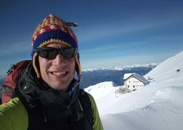
Rifugio Telegrafo
Route
Strada Val Trovai – Sentiero 654 – Rifugio Telegrafo – Ferrata delle Taccole – Rifugio Telegrafo
Remote and wild locations with a taste of alpine is what you are about to meet along this via ferrata. It is a must-do if you are an expert and you are in need of a whole day in the mountains, away from the crowd.
You will face the via ferrata after three hours walking. It has some difficult passages and it’s especially exposed along the crack, which gives to the Via ferrata his characteristic. It requires physical and psychological commitment as well as experience.
Via ferrata of Taccole description
Approach from trail 654
Walk along the tarmac road to find the beginning of the trail 654 (indications for Telegrafo and ferrata Taccole) and follow it to a white road inside a beech wood. You get to a clearing with a pool of pasture, three hundred meters after, take the trail on the right leading you back in the wood where it becomes an excursionistic single track. (Make sure not to walk along the forestal road that ends up under the wall, not far from there).
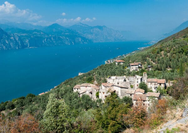
You will arrive at the crossroad indicating left for the Forcelin. From there head right and keep on walking for about two hours and an half following indications for Telegrafo. From there, the route alternates between gravel and trail with panoramic views on low Garda, the valleys, the glacial circle and Vetta delle Buse. Keep left at the crossroad with indications for Baito Buse and Turri, trail 55, remaining on trail 654. Just after that, the amphitheater under the Cima Telegrafo opens, with barren meadows typical of that altitude. Keep going until you get to the refuge that you will find just in front of you.
Approach from refuge Telegrafo
From refuge Telegrafo head south on trail 658 until you see the plate indicating “Via ferrata delle Taccole” on the right. To get at this start walk down the gravel descent keeping on the left to be sure not to miss it.
The Via ferrata
The ferrata is divided in three parts, with increasing difficulty. The start is challenging and technical and consist of a vertical 15/20 meters high chimney. Then you move diagonally on the right on small rocks to reach the beginning of the slab with the crack that gives the ferrata his characteristic. The slab is 35 meters long, slightly overhanged and the stirrup is quite far. This could be a bit more challenging for not very tall people.
The crack is equipped with stirrups and cemented stones. Just after the middle, the cable moves to the left inside a dihedral and this second part of the slab has more challenging moves than the others in the crack.
So take a deep breath before the last part, the hardest. It is about 25 meters and developes on a dihedral with a chimney crack. At the beginning there are lots of stirrups, then, in the final part, into the slightly overhanged chimney (sometimes moist) the difficulty increases. The final part is poorly equipped and you climb in adherence to the exit where there is a short ledge on the left.
Finally you head east, on rocky ledges, where you find a grassy and panoramic terrace with the summit book.
Descent
You go back to Refuge Telegrafo following the horizontal markings. You can descend on the left passing over some challenging boulders while on the right below you can see the path 658 that leads directly to Telegrafo. The exit is further south than the initial access on gravel, a bit under the Passo del Camino. Walk north to get back to the refuge.
Variant
You can enter the ferrata from the bottom without passing from refuge Telegrafo, it is the same access described in the approach to Molinaroli Alpine Route.
To make the ascent easier you can reach the refuge Telegrafo from Località Due Pozze and from there follow indications for refuge Chierego.
Our suggestions
Despite the long time needed for the approach, it has to be done at least once. Considering the that it is short (and intense) it should be included in an excursionistic day trip.
The ferrata is north exposed and the wall lies always in the shadow. It would be better to bring along your anorak and sweatshirt.
The tour during the winter
It is not possible to do it due to snow, because the ferrata is north exposed and in the Valle delle Pree there could be lot of snow accumulations. Call the refuge for informations before you leave.