A botanical treat valued amongst the most beautiful in Europe

Angela Trawoeger
Creator, photographer and content manager


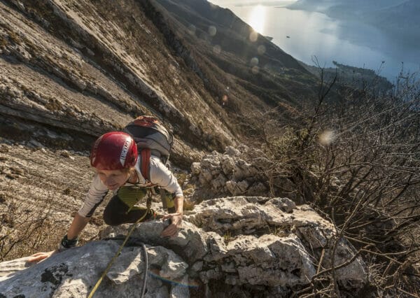
One of the most beautiful walks in this area that will bring you from Tratto Spino to the Ventrar path passing by Prai. The Ventrar route is a botanical treat and it known and valued amongst the most beautiful in Europe.
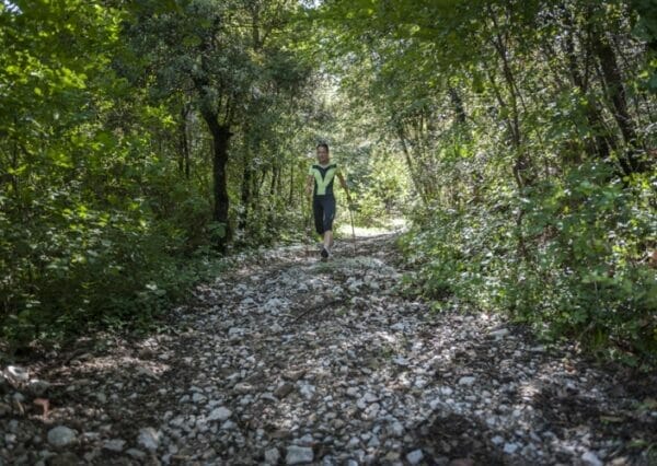
The walk itself is short and easy but you should be careful if following the Ventrar path (number 3) which is classified by the CAI as level EE (expert walker).
The tour is 5km long and has a total positive difference in height of 500m.
Maps and GPS Track
Details
-
Technical characteristics
-
Starting point
Tratto Spino
-
Endpoint
Tratto Spino
-
Route
Tratto Spino – Sentiero del Ventrar – Tratto Spino
-
Starting height
1760m
-
Highest point
1780m
-
Altitude – ascent/descent
514 m/506 m
-
Distance
4,88km
-
Duration
2 hrs
-
Starting point
-
Difficulty
-
Difficulty
middle to easy
-
Technical difficulty (1 to 5)
3
-
Physical training (1 to 5)
2
-
CAI (Italian Alpine Club) difficulty scale
EE: expert hikers*
*Mountain signs and Italian Alpine Club difficulty scale
-
Difficulty
-
Scenic appeal
-
Experience (1 to 5)
5
-
Landscape (1 to 5)
5
-
Experience (1 to 5)
-
Type of route
- Round tour
- Cable car ascent/descent
- Insider tip
- Panoramic route
-
Best time of year
-
From May to November
without snow
-
From May to November
Partner


Points of interest along this hiking trail
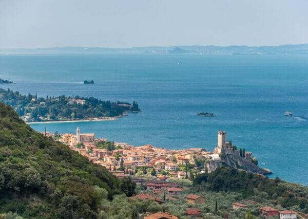
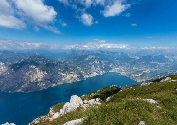
The Ventrar path is about a kilometre long and meets the north cliffs of the Colma di Malcesine which bring you to the eastern slopes of Monte Baldo. The path is rocky and spectacular with fabulous views over the Alto Garda region.
Ventrar path description
The path starts at the top station of the Cable car. Set off towards the north and just after the Funivia building take the first uphill on the left.
You will already be getting an idea of the beautiful views that await you over Garda!

Keep on going North, go under the ski lift wires at “Paperino” and then look carefully for the start of the path which is marked with red and white lines on a rock. The path heads off under the paragliding take-off area.
The track is narrow but not difficult, approx. 2 km long, mainly going downhill and it takes you to the meeting point with the Ventrar path. Here you turn right and enjoy the view!
Leaving the Ventrar path you can return to where you started from following the road on your left or otherwise by going up the path that you find in front of you. The path is fairly steep but short and brings you to Colma di Malcesine where you can walk along the plateau back to where you started from.
If you aren’t too tired, we recommend the path which is a little more challenging but brings you to the Colma di Malcesine and offers much better views than you have from the road.
Variant
This walk can be done the other way round.
Our suggestions
- To avoid the cable car queue during the high season you can go by car to the half-way cable car station in San Michele.
- Don’t do it by bike, you will have to carry your bike on your back over various sections and this can be dangerous.
The Ventrar path during the winter
The Ventrar path is closed as it is not passable in the snow.
Shelters, huts or bivouacs along the trail
- Baita dei Forti 10 metres from the cable car Station
- SkyWalk Lounge Bar Monte Baldo At the cable car station on Monte Baldo
- Bar Ristorante La Capannina At Colma di Malcesine
Partner

How to reach the starting point of the trail
The path starts at the top station of the cable car.
Click here to see rates, timetables and opening times.
Tel. +39 045 7400206
Parking
In Malcesine:
- Car park Campogrande
- Car park in Piazza Statuto
- Car park Paina
- In Malcesine, at the cable car station
- In San Michele, at the cable car middle station
Public transport
None
Safety information
- Along sections of the walk there are steel wires to hold on to which aren’t always necessary: be careful and always check the hand holds before using them.
- Take care when on the exposed parts of the path.
- Take extra care if walking when the path is wet.
- It is recommended not to choose this excursion in winter time, even in absence of snow during colder months: the path is north-facing and sunbeams never reach this area in winter.