Top 10 Lesser-Known Routes from Brenzone to Riva del Garda, up to Val di Ledro

Angela Trawoeger
Creator, photographer and content manager

Whether by bike, on foot, or with a climbing kit, at Lake Garda, you’ll always find the right trail for your needs. There are forest paths for quiet, scenic routes to enjoy the beauty of Garda and more challenging ones for those who want to work up a sweat.
There are the famous trails, the ones everyone knows, and they are beautiful. However, try them on weekdays, off-season, or early in the morning and you can enjoy them with fewer people around. You’ll be doing nature a favour, too.
In this article, we’ve picked ten less frequented routes that are as enchanting as the famous ones and sometimes even more so. Whether they’re easy walks or more demanding challenges, each path offers an opportunity to connect with nature and experience the beauty of Garda.
1 • Balot Tacà Via a Sommavilla di Brenzone
Easy • 1,5 hrs • 1,8 km • Ascent: 250m

The Baloc tacà via, also known as Baloc in Italian, “the hanging boulder,” is a large rock perfectly wedged between two high rock walls. It can be reached in about forty minutes by ascending the dry riverbed in Val Torrente. Go for it if you’re in the mood for an easy yet less trodden—and rugged—walk in a wild and secluded setting. Wear stout shoes that provide good ankle protection and avoid the hike on rainy days or the days following heavy storms.
Read more about Balot Tacà Via2 • Violet Tour – Monte Baldo South by E-MTB
Medium to easy • 5 hrs • 60,8 km • Ascent: 602m

Explore the two sides of Monte Baldo on this leisurely yet long tour amid views, pastures, and the trails of the most beautiful mountain in Lake Garda, also known as the Garden of Europe for its rich biodiversity. Asphalt stretches through beech and oak woods, alternating with more technical dirt tracks across the pastures. This route covers nearly all the climatic zones of Lake Garda, from 1780 meters at loc. Tratto Spino and about 70-80 meters above sea level in the lakeside towns
Violet Tour – Monte Baldo South by E-MTB3 • Sentiero degli Scaloni or delle Cavre in Dro
Easy • 3,5 hrs • 6,7 km • Ascent: 525m

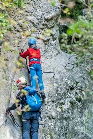
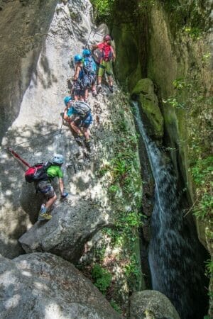
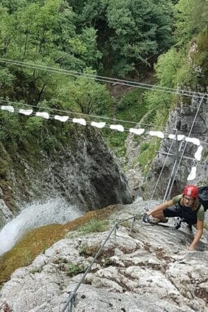
The “Sentiero degli Scaloni” is a historic trail built in the early 1900s by the Austrians above the small towns of Ceniga and Dro. This route is also known as “Percorso alle Cavre”. Cavre is the cradle once used as a cable car for transporting timber downhill. You’ll walk along partly cable-equipped paths, suspended ladders, and walkways. This route is perfect for getting started on via Ferrata climbing.
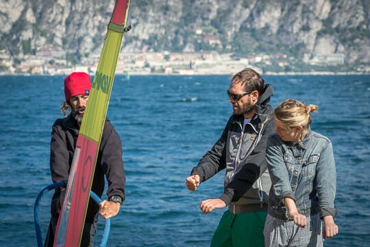
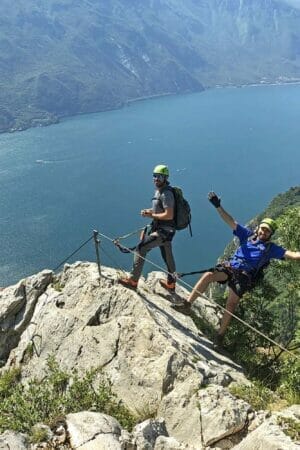
Sentiero degli Scaloni or delle Cavre di DroFirst time on a Via Ferrata?
Trust a Lake Garda Alpine Guide to lead the way


4 • Il Sentiero del Ventrar
Medium • 2 hes• 4,88 km • Ascent: 514m

This botanical paradise is judged among the most beautiful in Europe. The Ventrar cuts into the north face of Colma di Malcesine on Monte Baldo, taking you from the east side to the west in about a kilometre. The path is easy and short, but caution is required on the Ventrar Trail (number 3), classified by CAI as suitable for experienced hikers (EE).
Il Sentiero del Ventrar5 • Trail 654 of Monte Baldo
Medium to difficult – 3 hes – 5,6 km • Ascent : 1225 m

Located in Brenzone on Lake Garda, Trail 654 leads to the Telegrafo Refuge, the highest alpine refuge on Monte Baldo at 2147 meters. Expect a challenging trek through stunning and isolated natural surroundings. At the Telegrafo Refuge, you’ll find simple, traditional dishes focusing on local products.
Path 6546 • The Patriarch of Baldo
Medium • 3 hrs • 9,4 km • Ascent: 587m

The Patriarch of Baldo is a white fir listed in the Vallagarina Monumental Trees registry. Its candelabrum shape, with eight branches pointing towards the sky, is unique and imposing. Its trunk circumference is over 600 cm, one of the widest recorded for this species. This trek in Avio is perfect if you want to immerse yourself in the forest and breathe in its essence.
The Patriarch of Baldo7 • Cross Country Biking at Lake Ledro on Trail 729
Medium • 2,5 hrs • 15,8 km • Ascent: 528 m

We offer you an alternative tour of Lake Ledro that, in less than 3 hours and with the right amount of effort, offers constantly changing perspectives of this beautiful Alpine Lake. On your bike, whether muscle-powered or electric, you’ll transition from the beach to the forest, from asphalt to accessible dirt roads, ending with a refreshing dip in one of Trentino’s cleanest lakes.
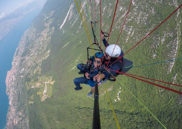
Cross Country Biking at Lake Ledro on Trail 729On an E-MTB at Lake Garda with a Local Guide
Are you alone or want to ride in a group but need help figuring out where to go? Let a local guide take you to the most beautiful spots.


8 • The Marocche di Dro
Medium to easy • 2 hrs • 5,5 km • Ascent: 178 m

The Marocche di Dro, from “Maròc”, meaning “rock block” in the Trentino dialect, is located between Dro, Lake Cavedine, and Drena. The Marocche are debris from landslides on Monte Brento caused by the retreat of the glacier that once occupied the Sarca Valley. This easy circular walk takes you through a nearly lunar, rocky desert landscape where flora and fauna have adapted to a predominantly arid environment.
The Marocche di Dro9 • Gorg D’Abiss
Medium to easy • 3 hrs • 7,3 km • Ascent: 411m

Gorg d’Abiss, Gorg d’Abiss, a vortex of the abyss, is the name of the waterfall in Tiarno di Sotto, in Val di Ledro, carved by the Massangla stream into the rock. It’s a small cascade of clear, turquoise water that falls along the walls of a cave, creating a mountain lake. This mostly paved loop trail is for you if you need a walk in the woods.
Waterfall Gorg D’Abiss10 • The Villages of Brenzone on Lake Garda
Easy • 2,5 hrs• 13,2 km • Ascent: 550m

Brenzone on Lake Garda is unique in that it doesn’t have a main centre but consists of 16 small hamlets scattered along the inland slopes alternating with vast natural areas. In addition to the 16 hamlets, there are numerous locations often made up of 4 or 5 houses, many of which are named with the prefix “Cà” (meaning “house” in dialect) and the surname of the family that lived there. This easy route lets you visit 14 of them on the hillside and along the beach. If you go in the summer, bring your swimsuit.
The Villages of Brenzone on Lake Garda