Ora, Pelèr e Balin: thermal winds in the north part of the lake

Giacomo Milani
Windsurf, mountain bike and paragliding

Angela Trawoeger
Creator, photographer and content manager
Wind is determined by air movements caused by different temperatures and pressures from one place to another, where the air current moves from the high pressure zone to the low pressure zone.
How and when the Lake Garda winds are formed
Lake Garda is a mountain lake which opens out onto the Padana plain. The two main lake Garda winds are thermal winds, which means they are bonded to the heating of the earth and water. This means that the lake Garda winds are the result of an interplay of meteorological conditions between the mountains and valleys, conditions in which stability or changes of thermal movements play an important part.
There are two typical winds in Malcesine: Pelèr, the northerly morning wind, and Ora, the wind from the South, which usually starts after the Pelèr drops down. In the summer time a storm during the day can cause a wind inversion, often very strong and dangerous. Usually this wind inversion is from a South wind changing to a North wind, and very rarely the opposite way.

The sailors of the lake say: “Every shore and place on the lake has its own wind!”. Knowing and observing the lake, it’s possible to learn to recognize the signals which announce a weather change or the arrival of a particular wind.
Partner
Pelèr (Vento or North wind)

It is the King of all lake Garda winds, a “good weather” wind.
It is constant and steady in the summer time, and starts to blow between midnight and 3am, generally in the north and the centre of the lake, then, with the sunrise, it spreads all over the lake. The moment that this wind shows its most power is when the sun-rays light up the water of the west coast.
The Pelèr can last about 12 hours when it builds up more strongly than usual, 4/5 Beaufort; in these conditions if can last until 14:00 or 15:00 o’clock, although it often dies down around 11:00 am.
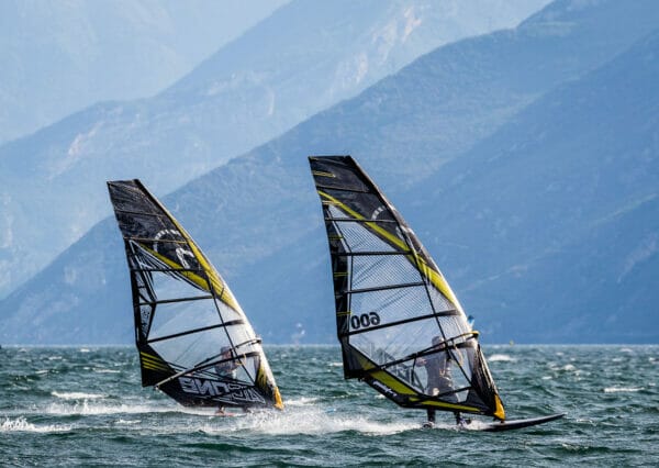
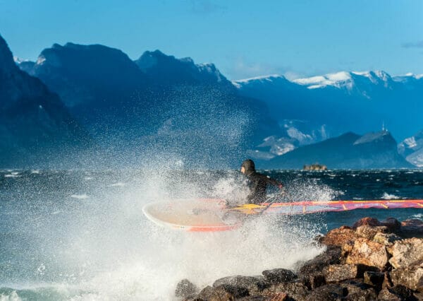
A characteristic of the Pelèr is that it can form small sets of waves, much bigger and more upright than the regular motion of the lake, creating great spring-boards for wind-surfers and kiters. The Pelèr generates a lot of currents and waves which bring the cold water from the depth of the lake to the surface. After the Pelèr the lake water is clear, and, in the afternoon, there can be currents from the South to the North.
Ora (South wind)
The most famous Garda wind.
The Ora starts when the Pelèr drops between 12:00 and 1:30 PM, and ends, in normal conditions, at sunset.
The most famous Garda wind blows from the South and builds itself from many smaller winds that meet between Gargnano and Brenzone. It’s quite regular in spring time and in the beginning of the summer, getting weaker when the air temperature gets super-hot and the change of temperatures between day and night is not so marked. To make a strong Ora, there need to be strong sun-rays reflected from the water and the mountain around the northern part of the lake. That’s why when the sky becomes too cloudy the wind will become weaker or even die completely.
Partner
Ora create a very small chop on the lake with little or no current. The further up the lake it blows the stronger it gets;
this is caused by the Venturi effect: the mountain chains around the lake the render the north end of the lake much narrower than in the south.
Its wind force varies considerably:
- Brenzone: 1/2 Beaufort
- Campione: 3/4 Beaufort
- Malcesine: 2/3 Beaufort
- Navene: 3/4 Beaufort
- Torbole: 4/5 Beaufort
Attention: when there is already wind blowing from the South in the morning, it’s highly likely that bad weather is coming, which might bring rain or storms throughout the day.
Balin (o Balì, Balinot)
The Balin comes from the Ballino mountains over the North Western valley of Riva. The Balin comes after a snowfall on the mountains or in the summer time after a strong temperature fall, generally caused by a rain storm.
It comes from the same general direction as the Pelèr, but slightly more North-Eastly. It blows stronger then the Northern morning wind (Pelèr), in fact it can reach 6-8 Beaufort. It usually blows just for the hours after the storm until night time, but sometimes can even last for the next 2-3 days. It creates a big swell on the lake, forming waves higher then 1,5 meter.

Partner
It’s very important to know that the Balin arrives quickly and often unexpectedly. In very short time the wind can increase from a light breeze to a strong wind with 40 knots! The Balin is easy to recognize when coming: looking towards the North, the water starts to form waves with white foam, with the wind directly behind the waves.
One can not underestimate lake Garda.
We say that the exceptions confirm the rule, so all this information is without warranty.
Good wind to everybody!


